
Site Development and Utilities in Fort Collins and the Poudre Corridor
Water decides what can be built on a northern Colorado site, and it usually does so in two ways. Rain falls on the site and has to be directed to a detention facility and an outfall that the city will accept, and the Cache la Poudre River or one of its tributaries sometimes crosses the same ground. A site plan that treats those two facts as afterthoughts fails review or fails in the next big storm, and the cost of fixing either falls on the owner.
Site development is the work that makes a parcel ready for a building: clearing and grading, utility mains and services, stormwater facilities, access roads, paving and landscape. We plan it together with the building rather than after it, because the sequence of the first few weeks determines how smoothly everything else goes. A site that is graded to drain, with utilities in the right places and a stable construction entrance, is a site where the trades can work.
Floods, Soils and Surprises
A late July 1997 flash flood in Fort Collins followed 10 to 14 inches of rain over 31 hours, killed five people, caused about $5 million in city damage and about $140 million in damage to Colorado State University. The Cache la Poudre River flows through Fort Collins and is subject to sudden, destructive floods; in 1864 one destroyed Camp Collins at La Porte, and the city still experiences periodic flooding from the river. Those histories are why floodplain mapping, freeboard and stormwater design carry real weight in plan review.
Soils vary widely across short distances, from river gravels to expansive clays, and groundwater can rise in wet years. We ask for a geotechnical report before earthwork is priced and review it for the details that drive cost: over-excavation, subdrains, moisture conditioning and pavement sections. Where the report identifies risk, we show the owner the options and costs.
What the Package Includes
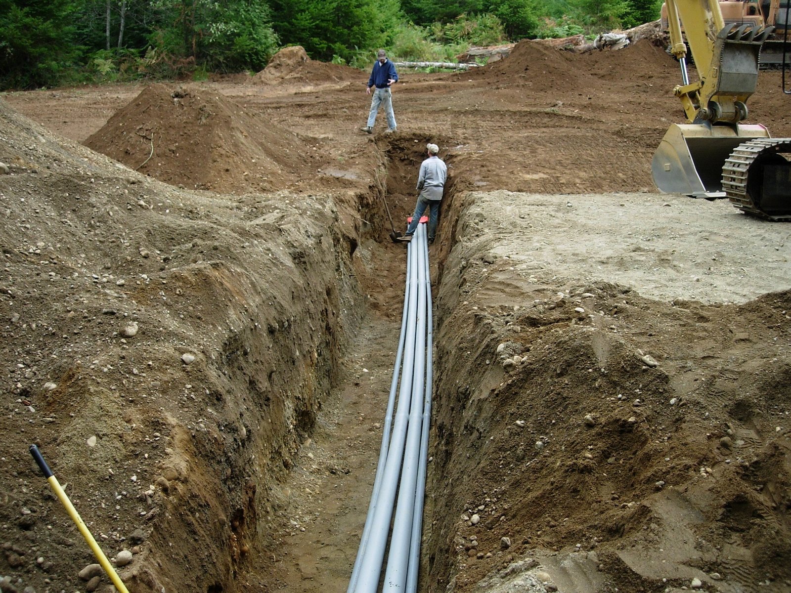
The scope usually begins with erosion and sediment control, a construction entrance and stripping of topsoil. Mass earthwork follows, described in more detail on our mass grading page, then underground utilities: sanitary sewer, water, storm drain, gas and conduit for power and communications. After the building pad is complete, we install curb, base and paving; our work on parking lot construction covers that stage.
Stormwater features get their own attention. Detention ponds, water quality basins, inlets and outfalls are sized by the engineer and inspected by the municipality, and many cities require long-term maintenance access. We build to the approved plan and keep records of as-built elevations to support final acceptance. For design details, see stormwater and drainage.
Permits and Utility Approvals
Site work needs its own approvals: grading or stormwater permits, utility main extension agreements, work in the right-of-way and, for sites near the river, floodplain development permits. Each approval has its own timeline, and some depend on others. We set up a permit matrix at the start and track each item. The process is described further under permitting and entitlements.
Fort Collins lists a 30 inch frost depth in its design criteria, which sets the minimum depth of water services and footings. Estes Park, at 7,743 feet elevation, has a required freeboard standard of one foot after the 2013 flood, and mountain sites bring slope stability and access issues. We apply the standards of the jurisdiction where your site lies and verify them with the local staff.
Work We Manage Directly
Early site work shapes everything that follows, so we keep layout, grade control and coordination of the underground contractors under our direction. Our superintendents check inverts, slopes and compaction as the work proceeds and keep photographs of every utility before backfill.
We also manage the tie-ins to existing mains, which require coordination with the utility, a shutdown plan and a short, scheduled outage. We prepare these as written procedures and notify neighbors in advance.
Growth Areas We Watch
Timnath illustrates how quickly sites change. The town grew from 625 residents in 2010 to 6,487 in 2020, with a 2025 Census Bureau estimate of 11,600, and Ladera is a 240 acre mixed-use land offering at the southeast corner of East Harmony Road and I-25. Large parcels like this need phased infrastructure, with trunk utilities and drainage planned for the whole before the first lot is built. Our page on Timnath discusses the area.
We also work upstream near Laporte, where the river leaves the foothills, and in mountain communities such as Estes Park where access and slopes dominate. Multifamily developers building in these growth areas frequently ask us to price site work first, since it frames the project's feasibility.
Sequencing Around Weather
Earthwork depends on the weather. Wet clay cannot be compacted, frozen ground cannot be graded, and spring runoff can swamp a half-built basin. We build the site schedule with weather days in mind, protect open excavations, and phase the work so that the stormwater controls are installed first.
We aim to have utilities in and the pad ready ahead of the vertical trades, so the building crews are not waiting for water or power. Late utility connections are one of the most common delays on commercial projects, and we track them from the first week.
Start With the Ground
Send us the parcel, the survey and any geotechnical report. We will review grading, utilities and stormwater, and give you an early read on cost, permits and schedule.
Questions Owners Ask
Do we need a geotechnical report before bidding site work?
Yes, strongly recommended. Without one, earthwork, subgrade and pavement costs are guesses. We can help you scope the borings and testing so the report answers the questions that affect cost, such as groundwater depth, expansive soils and the need for over-excavation.
How much land do stormwater facilities take?
It depends on the site, the soils and the city's standards, but on many commercial sites detention and water quality features take a significant share of the lot. We test-fit them early, and look for ways to integrate them into landscape or parking areas where permitted, so the buildable area is clear before purchase.
What changes if the site is near the river?
Floodplain mapping, freeboard requirements, geotechnical conditions and permit review all change. Buildings may need to be elevated or floodproofed and fill may be restricted. After the 2013 flood, Estes Park adopted a required freeboard of one foot, and the post-flood report noted that every damaged building was outside the mapped floodplain. We advise owners to treat mapped boundaries with caution.
Who coordinates the utilities?
We do. We make the applications, track the review, coordinate the main extension or service connection and schedule outages. Utility providers have their own priorities, so we start early and keep the relationship active. A named person on our team is responsible for each utility.
Can site work be phased for a multi-building project?
Yes. We design the infrastructure for the whole site, then build the portions needed for each phase, with stubs for future extensions. Detention basins are usually built first and sized for the full site or enlarged later. Phasing saves cash but requires careful planning to avoid tearing up finished work.